Since 1967 Berkshire Natural Resource Council (BNCR) has worked alongside many Berkshire landowners to open land to everyone and keep it natural through preservation. As the lands they protect continue to grow, it is sometimes hard to become familiar with all of them, even when some are close enough to each other to hop from one to another. Here are three properties close enough to each other that my family and friends and I enjoy visiting them all on a fall afternoon.

Parsons Marsh
Take a right across the road from the entrance to Tanglewood, on Route 183 in Lenox and drive north on Under Mountain Road. A short drive will take you to the Parsons Marsh sign on the right and the trail head across the road from Stoneover Farm.
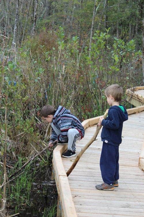
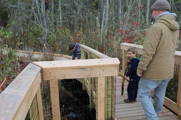
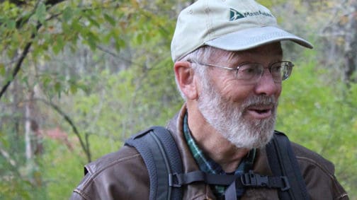
As we arrived recently, we were surprised by BNCR’s Land and Trails Coordinator, Michael Leavett, and Ken Kelly, President of The Lenox Land Trust, among others in a small group. I had been here twice this week, this time to show it off to our younger grandsons, Paddy, 7, and Gabo, 5, and their dad, Patrick O’Connor.
They love outdoor adventures, and even though we were going exploring on our own, Leavett provided us fresh cider droughts.
Ken Kelly, President of The Lenox Land Trust, and his organization were influential in opening Parson's marsh to the public.
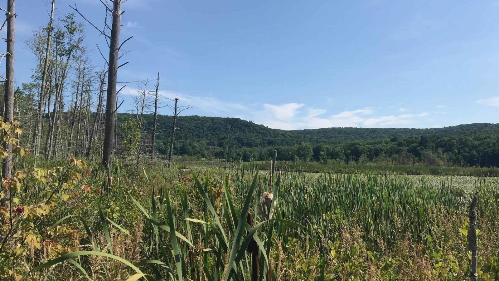
Parsons Marsh Reservation preserves a varied habitat in more than 180 acres of field pine and hemlock extensive hardwood forests, brook, with shrubland, leading to cattail marsh, and pond.
An accessible boardwalk leads the visitor across the lowland wet places to cattail marsh and open pond, 183 acres, half with a half hard-packed surface that looks like recycled black top, and the boardwalk keeps the feet dry —a craftsman’s touch by Peter S. Jensen & Associates, LLC.
Beneath heavily used areas like the kiosk, benches, and a small picnic area, perforated Ekomats (converted plastic shopping bags and other waste plastic film, something new to me) cover n a bed of compacted recycled glass aggregate, showing us BRNC’s ethical use of recycled materials in new construction.
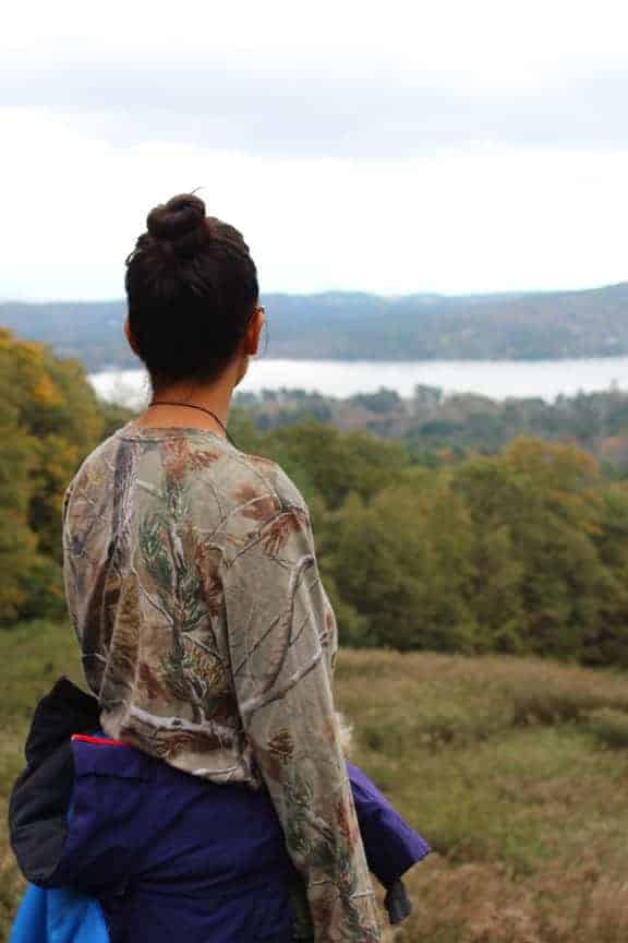
Olivia’s Lookout
One of Lenox’s most-visited trail heads overlooks a wide vista, and you don’t have to get out of your car, although you would be cheating yourself for not stretching your legs and taking in the full panorama, Stockbridge Bowl and the Berkshire Hills.
From Route 183 as you pass Tanglewood, as Route 183 curves left, bear right onto Richmond Mountain Road (the sign says to Route 41/Richmond). After a mile and a half, the lot will come up on your left. The Overlook sits at the center of the 734-acre Yokun Ridge Reserve.
This popular pull off overlooks Stockbridge Bowl and also serves the trailhead for the six miles of trail that BNRC maintains on Yokun Ridge.
From here you can easily access Charcoal and Burbank trails. These trails connect to Brothers Trail, and lead you to Monks Pond, and nearly to Jackson Pond’s boardwalk.
The trails also include the easy access Walsh Trail, a gradual climb to stunning views all the way to Great Barrington, and the long interlocking loops of the Burbank and Brothers Trail.
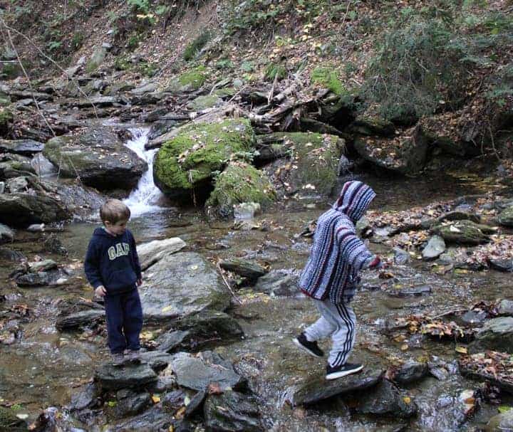
Hike the Burbank Trail down to Monks Pond. Or take your children in warmer weather on the Brothers Trail to explore the pools of Shadow Brook.
Steven’s Glen
Steven’s Glen offers tranquility without trying. Spreading into West Stockbridge from Richmond, this serene place use to be a magnet for party goers. The land was first settled by the Stevens family in 1760, and a century later became a hidden refuge.
It became a coach party destination in the late 1800s, and in 1919 it was the site of a party for 900 people, boasting a dance pavilion with an oak floor and a bridge over the ravine.
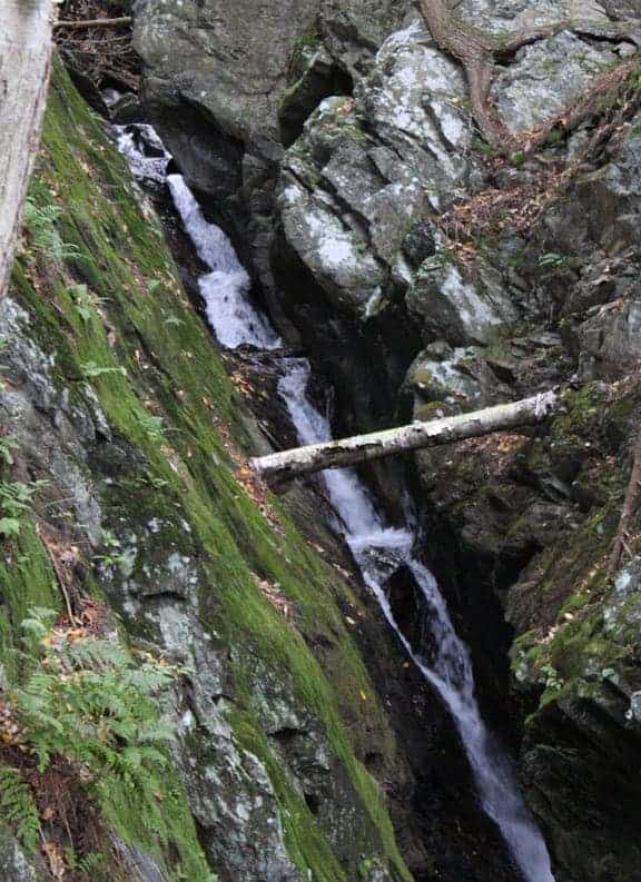
It might have remained a place of bourgeoise dance parties, except for the need to clear the land to prevent the spread of the American Chestnut disease. Today the chestnut forests are gone to new diversified growth, and the glen leads to an impressive gorge cut by the cascading forty-foot falls of Lenox Mountain Brook.
The trail to the glen is just over a mile, round-trip, taking about an hour of mostly moderate walking with some steep climbs to a safe viewing platform.
From Tanglewood, again when Route183 bears left, take the right onto Lenox-Richmond Road. Follow it up the hill for 1.6 miles and turn left on to Lenox Branch Road, also called Lenox-West Stockbridge Road. About half a mile farther on, the lot will appear on the right at the sign.
All of these properties have free admission for hikers — and hunters. While walking a trail at BNRC’s Constitution Hill in Lanesborough I once was briefly startled by coming upon a camouflaged turkey hunter standing against a large ash tree. We exchanged a quiet greeting and each resumed our sport.